


Funding Body
EU � Civil Protection Financial Instrument
Year of start/end
2012 / 2013 (Ended)
Project Web SiteActivity
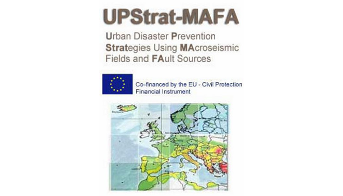
Project summary � UPStrat-MAFA
The first step in seismic risk analysis for disaster prevention strategies consists of (a) evaluation of the hazard (probability that a shaking exceeds a prescribed value in a coming time interval) and (b) forecast of the damage scenario that a future earthquake can cause.
Innovative approaches are proposed to improve critical points in the procedures to operate in probabilistic hazard assessment and are tested in particular locations � Mt. Etna, Vesuvius and Campi Flegrei areas (Italy), Azores Islands and areas hit by offshore activity (Portugal), Southeast Spain (i.e. Alicante-Murcia) and South Iceland including Reykjavik surrounding urban area (Iceland).
The second step consists in the improvement of urban scale vulnerability information on building and network systems (typologies, schools, strategic buildings, lifelines and so on); definition of urban risk convolving the shaking ground motion parameters at site with vulnerability and finally, design some disaster prevention strategies based on different levels of risk. Education management information system data should be linked to information about areas and population groups that are prone to particular kinds of emergencies. This is a preparedness strategy that provides input into national and local education planning.
Project details � UPStrat-MAFA
Earthquakes have been the cause of the deadliest natural disasters over the past century, with the first decade of the 21st century as one of the most devastating periods. Due to the high number of factors that contribute to earthquake occurrence, their prediction is extremely difficult. At the moment, large efforts are being lavished by the international community in scientific and economic terms, in studies for the probabilistic short-term and long-term earthquake forecasting and for simulation aspects of the generation process in order to reduce the risk and to mitigate the damage and its impact. A key point is the hazard evaluation: the procedures currently used can be first classified as probabilistic or deterministic; the former exploit essentially historical information provided by catalogues and macroseismic intensity data, whereas the latter are based on physical modelling of the sources and the geological information. In principle, these two approaches provide complementary information that should be effectively merged to improve the resulting hazard estimates. However, merging these outcomes is a difficult task because of the basically different epistemic perspectives and the different nature of the expected results (ordinal and discrete intensity data in one case, spectral or peak parameters in the other).
We propose an innovative approach in which a unique probabilistic procedure processes both macroseismic fields and historical information, as well as the characteristics of fault sources [2, 4, 5, 6]. The direct application of probabilistic methodologies to observed and/or synthetic macroseismic fields (without filtering the information through empirical attenuation relationships) allows us to carry out a more complete treatment of the uncertainties in the case of both the point-wise and linear properties of the fault. In this way, the integration is made at the level of the input data: in the framework of the metrics of 3D faults, the finite-fault properties � directivity effects, heterogeneous slip distribution, position of the nucleation point, location of areas of large moment release � will be used: (i) to generate the ground motion shaking through stochastic high frequency simulation [1,3]; and (ii) to create a synthetic intensity field database that complements the existing data for different intensity scales and considering site-effect corrections. A particular care will be devoted to the calibration of the input parameters for the simulation applied to the volcanic area. Anelastic attenuation, stress drop, spectral features, magnitude will be investigated for the selected events.
The second step focuses on the vulnerability assessment of urban areas, which includes the study of the main variables that control the seismic vulnerability of various buildings and network systems. The urban risk will result from the convolution of ground shaking with the vulnerability. The levels of uncertainty will be obtained from both the ground shaking and the vulnerability. A methodology will then be applied to define the mitigation policies. This outcome will be of most relevance to the Civil Protection and other final beneficiaries. Recent and past earthquake impacts have shown that involving community and citizen in decision-making is of major importance, to prioritise the mitigation and response. The education, training and community involvement aspects should be handled afterwards, with the collaboration of Civil Protection.
The project aims at the implementation of innovative prevention approaches to consistently link prevention measures to preparedness and response needs. To support the decision-making, several projects have already been developed, like simulators, vulnerability assessment of buildings, non-structural components, critical assets, lifeline (critical) infrastructures, and others. Despite these many efforts, neither functional interdependencies (propagation effects) nor intervention strategies or priorities have been incorporated as final tools in the support of decisions for risk-reduction policies [7,8,9].
In this project, tools that are specifically devoted to the identification of priorities will be delivered. First, a new concept of global disruption measures is introduced, with the objective to provide a systematic way to measure earthquake impact in urban areas. Then, a framework is provided where urbanised areas are seen as a complex network where nodal points have roles as sources and sinks, interacting together in an interdependent fashion. Here, each player (urban functions or physical assets) has its unique dependencies and interaction behaviour. These properties are then used to identify which nodes are likely to introduce major disruption in the whole urban system, and also which one of them suggests greater risk reduction if intervention takes place. The convolution of ground motion and vulnerability/ impact will be based on a Monte Carlo simulation, where uncertainties of both processes will be dealt with. This approach provides the Civil Protection, the authorities and local decision makers with a new tool that goes beyond the “What happensâ��; instead, it dips into the “What should we do in order to minimize the consequences of what is expected to happenâ��, so as to prioritise mitigation and response actions.
Main References
[1] Zonno G., Oliveira C.S., Ferreira M.A., Musacchio G., Meroni F., Mota-de-Sà F. and Neves F. (2010) Assessing seismic damage through stochastic simulation of ground shaking: the case of the 1998 Faial Earthquake (Azores Islands). Surv Geophys (2010) 31:361-381 DOI 10.1007/s10712-009-9091-1
[2] Zonno G., Rotondi R. and Brambilla C. (2009) Mining Macroseismic Fields to Estimate the Probability Distribution of the Intensity at Site. Bull. Seismol. Soc. Am.; October 2009; v. 99; no. 5; p. 2876-2892; DOI: 10.1785/0120090042
[3] Galluzzo D., Zonno G. and Del Pezzo E. (2008) Stochastic Finite-Fault Ground Motion Simulation in a Wave Field Diffusive Regime: Case Study of the Mt. Vesuvius. Bull. Seismol. Soc. Am., Vol. 98, No. 3, pp. 1272�1288, June 2008, DOI: 10.1785/0120070183
[4] D'Amico V. and Albarello D. (2008) SASHA: a computer program to assess seismic Hazard from intensity data. Seismological Research Letters Volume 79, Number 5 September/October 2008 - DOI: 10.1785/gssrl.79.5.663
[5] Sigbjï��rnsson R, �“lafsson S, Snï��bjï��rnsson JT (2007) Macroseismic effects related to strong ground motion: a study of the South Iceland earthquakes in June 2000. Bull Earthquake Eng, 5(4), 591-608. DOI:10.1007/s10518-007-9045-2
[6] Rupakhety,R., Sigurdsson, S., Papageorgiou, A. S., Sigbj�rnsson, R. (2011) Quantification of ground-motion parameters and response spectra in the near-fault region. Bull Earthquake Eng. DOI: 10.1007/s10518-011-9255-5
[7] Costa AC, Sousa ML, Carvalho A and Coelho E (2010) Evaluation of seismic risk and mitigation strategies for the existing building stock: application of LNECLoss to the metropolitan area of Lisbon. Bull Earthquake Eng, DOI: 10.1007/s10518-009-9160-3
[8] Neves F., Costa A., Vicente R., Oliveira C.S- and Varum H. (2011) Seismic vulnerability assessment and characterisation of the buildings on Faial Island, Azores. Bulletin of Earthquake Engineering. DOI 10.1007/s10518-011-9276-0
[9] Oliveira, C.S., Ferreira, M.A. and Mota de Sá, F. (2011) The concept of a disruption index: application to the overall impact of the July 9, 1998 Faial earthquake (Azores islands) (submitted to the Bulletin of Earthquake Engineering)